about
free
exclusive
patterns
vector
microstock
premium
log in
sign up
about
free
exclusive
patterns
vector
microstock
premium
log in
sign up
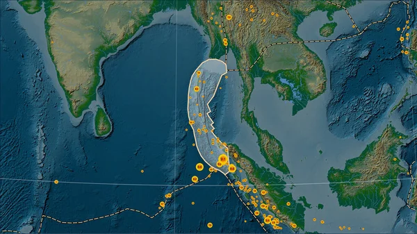
Locations of earthquakes in the vicinity of the Burma tectonic plate greater than magnitude 6.5 recorded since the early 17th century on the physical elevation map in the Patterson Cylindrical (oblique) projection
Keywords:
aerial view
water
world map
nature
space
map
backgrounds
illustration
topography
land
cartography
planet
Select...
photo, drag here or paste
How to get an image URL
Right-click an image on the web and copy the image’s URL. Return to the search box and paste in the URL (Ctrl+V or Command+V).
By staying on our site, you agree to our use of cookies. Read more in the
cookie policy