about
free
exclusive
patterns
vector
microstock
premium
log in
sign up
about
free
exclusive
patterns
vector
microstock
premium
log in
sign up
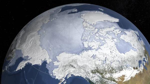
Satellite image of the sea ice maximum extent in the north hemisphere. Elements of this images furnished by NASA/Goddard Space Flight Center Scientific Visualization Studio
Keywords:
blue
sphere
world map
nature
space
map
global business
physical geography
topography
global communications
cartography
africa
planet
sea map
map hemisphere
Select...
photo, drag here or paste
How to get an image URL
Right-click an image on the web and copy the image’s URL. Return to the search box and paste in the URL (Ctrl+V or Command+V).
By staying on our site, you agree to our use of cookies. Read more in the
cookie policy