about
free
exclusive
patterns
vector
microstock
premium
log in
sign up
about
free
exclusive
patterns
vector
microstock
premium
log in
sign up
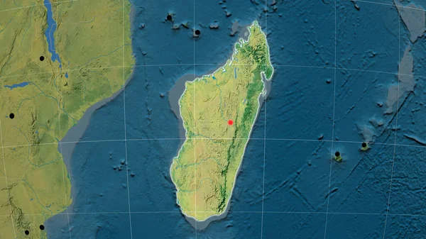
Madagascar outlined on the topographic orthographic map. Capital, administrative borders and graticule
Keywords:
blue
digitally generated image
map
topographic map
illustration
physical geography
satellite view
topography
cartography
topographic map illustration
Select...
photo, drag here or paste
How to get an image URL
Right-click an image on the web and copy the image’s URL. Return to the search box and paste in the URL (Ctrl+V or Command+V).
By staying on our site, you agree to our use of cookies. Read more in the
cookie policy