about
free
exclusive
patterns
vector
microstock
premium
log in
sign up
about
free
exclusive
patterns
vector
microstock
premium
log in
sign up
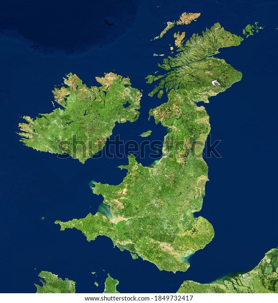
UK map in satellite photo, England terrain view from space. Physical map of Great Britain and Ireland islands. Detailed aerial photography of United Kingdom. Elements of image furnished by NASA.
Keywords:
no people
aerial view
computer graphic
digitally generated image
water
nature
map
travel
illustration
landscape
topography
design
cartography
Select...
photo, drag here or paste
How to get an image URL
Right-click an image on the web and copy the image’s URL. Return to the search box and paste in the URL (Ctrl+V or Command+V).
By staying on our site, you agree to our use of cookies. Read more in the
cookie policy