about
free
exclusive
patterns
vector
microstock
premium
log in
sign up
about
free
exclusive
patterns
vector
microstock
premium
log in
sign up
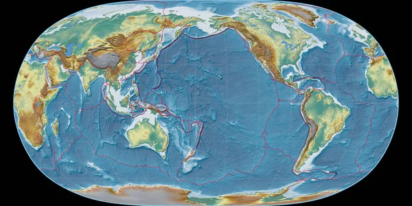
World map in the Natural Earth projection centered on 170 West longitude. Topographic relief map - composite of raster with graticule and tectonic plates borders. 3D illustration
Keywords:
blue
sphere
world map
nature
space
map
global business
science
global
physical geography
topography
planet - space
land
global communications
cartography
africa
global map
earth topography
natural world
the natural world
world space
topographic map illustration
center of earth
world topographic map
Select...
photo, drag here or paste
How to get an image URL
Right-click an image on the web and copy the image’s URL. Return to the search box and paste in the URL (Ctrl+V or Command+V).
By staying on our site, you agree to our use of cookies. Read more in the
cookie policy